The Lead
The Israel Defense Forces (IDF) released an official map Thursday afternoon outlining its security zone in southern Lebanon, confirming that Israeli forces are currently deployed up to 10 kilometers north of the border. The military stated that its positions are established in accordance with operational requirements to eliminate threats and secure northern border communities.
Official Deployment Line
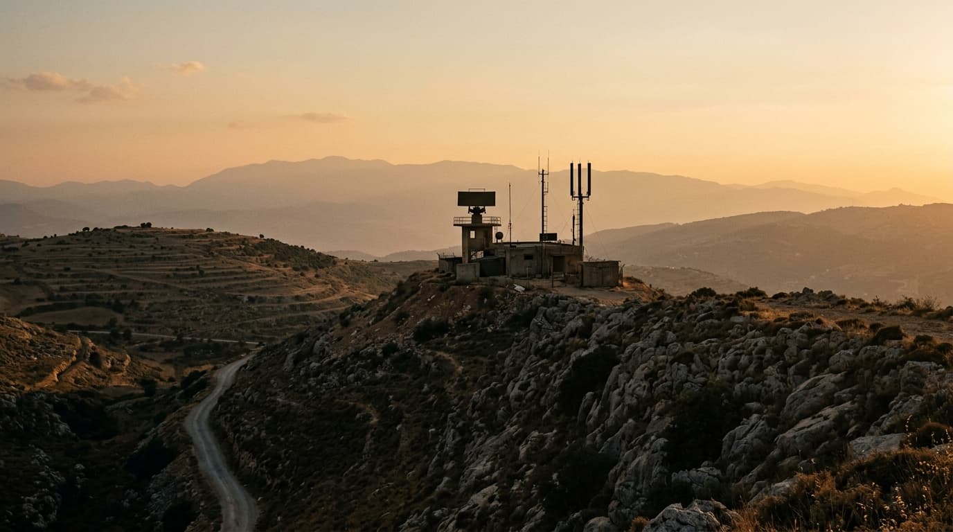
The IDF's publication of the updated map provides a rare official look at the current extent of Israeli military control in southern Lebanon. According to the map and accompanying military statements, the deployment line—often referred to as the 'Yellow Line'—now encompasses strategic areas including the Ali al-Taher ridge, Kfar Tibnit, and Majdal Zoun. This deployment marks a significant presence intended to prevent the re-establishment of Hezbollah infrastructure near the Israeli border.
Strategic Context
The establishment of this security zone follows months of high-intensity operations. While diplomatic negotiations between Israel and Lebanon are reportedly ongoing, the IDF emphasized that its control of this territory will be maintained as long as operational requirements dictate. The military has also called on the Lebanese Armed Forces to coordinate their movements with Israeli forces and avoid entering this designated security zone while active operations continue.
Analysis and Outlook
By formalizing the map of the security zone, the IDF is signaling a transition from a fluid battlefield to a more stabilized defensive posture. Analysts note that the inclusion of the Ali al-Taher ridge is particularly significant due to its topographical dominance over the surrounding area. The military's focus remains on the 'removal of threats'—a term that includes the destruction of tunnel networks and launch sites. The situation remains developing as the diplomatic track continues, with negotiating teams expected to meet again next week.
6 developments
- The Zioneer Intelligence Desk
- Jimmy Kimmel skewers Trump's Iran deal as a giveaway to Tehran
- Netanyahu to Trump: Israel won't leave Lebanon security zone while security needs require it
- Yachad holds emergency meeting as polls slide — party sources say
- Forum of Valor board member Itzik Pittussi: Israel must not allow UNIFIL to operate near border amid collaboration reports